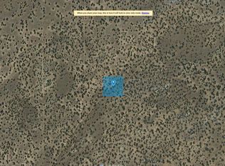
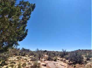
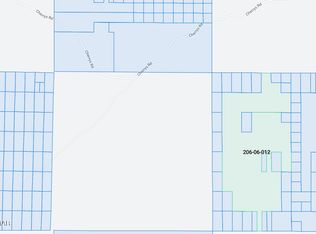
Location Description: CEDAR HILLS UNIT 2 AMENDED Lot: 2 Section: 21 Township: 18N Range: 27E T R S T-18N, R-27E, S-21 Parcel Size 2.5 Number of Parcels 1 GPS Coordinates GPS Center 34°57'2.57"N, 109°28'23.06"W GPS NW 34°57'4.16"N, 109°28'25.02"W GPS NE 34°57'4.13"N, 109°28'21.06"W GPS SE 34°57'0.88"N, 109°28'21.07"W GPS SW 34°57'0.91"N, 109°28'25.02"W Google Map Link https://goo.gl/maps/TbQsYDMQ8QMLwbPS8 Access Road Unnamed dirt road. Road Surface Dirt Road Maintenance County Elevation (ft) Low: 6409 ft. / High: 6422 ft Terrain Type Flat, Desert, Plain. Closest Highways US HWY-40& 1291, RT-61. Closest Major Cities Winslow, Holbrook, Gallup. Nearby Attractions Petrified Forest National Park, Crystal Forest, Painted Desert, Window Rock Tribal Park & Veteran's Memorial, Rainbow Forest Museum.
This property is off market, which means it's not currently listed for sale or rent on Zillow. This may be different from what's available on other websites or public sources.