$--
Fees may apply
- 1 bd
- 1 ba
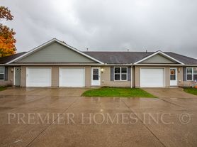
Liberty Heights, One Bedroom
For rent

Use our interactive map to explore the neighborhood and see how it matches your interests.
ZIP code 44601 covers Alliance and the nearby communities of Limaville, Maximo, New Baltimore, Mount Union, Alliance Junction and Beechwood, across a largely level landscape in northeast Ohio. Winters are cold and snowy, while summers are warm and humid. Alliance’s history is reflected in its railroad connections and historic downtown, where local shops, cafés and restaurants offer everyday stops; Mount Union adds a college-town presence. Parks and open spaces provide room to walk and play outdoors, and public library services are available in the area. Local dining and shopping are concentrated around Alliance, with quieter rural roads beyond it. Driving is the most practical way to connect the spread-out communities, while rail and bus options are more limited. For ZIP code 44601, the median rent is $850 per month, with a typical range of $495 to $1,600, based on 35 active listings.
Powered by Zillow data and AI technology.
Alliance Towers is located at 350 S Arch Ave, Alliance, OH. The surrounding area includes multiple restaurants and cafes within 2 miles, such as Life In The Son Ministries, Grumpy Troll Coffee, and Victorio's Pizza.
The closest hospitals and medical facilities to Alliance Towers include Carnation Clinic (0.7 miles away), Family Medical Center of Alliance (0.9 miles away), and Childrens Clinic (1 mile away).
The schools assigned to Alliance Towers include Alliance Early Learning School, Alliance Middle School, and Alliance High School.
Alliance Towers is located near 5 grocery stores, including Alliance Farmers Market (0.2 miles) and Thornes IGA (0.4 miles). Additional shopping options, including Dollar General, are approximately 0.3 miles away.
Alliance Towers is located within 0.5 miles of Dewald Chapel, 0.6 miles of New Zion Baptist Church, and 0.9 miles of Alpha Delta Pi.
Claiming gives you access to insights and data about this property.