$954 - $2,069
- Studio+
- 1+ ba
- 396+ sqft
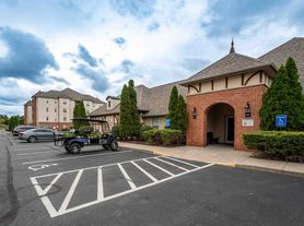
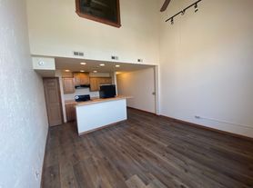
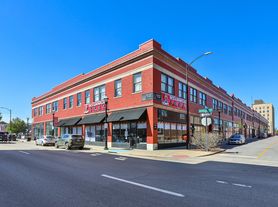
SoEl District Lofts
For rent

Use our interactive map to explore the neighborhood and see how it matches your interests.
ZIP code 65803 covers Tom Watkins, Midtown, Doling Park, Robberson and Woodland Heights in northern Springfield. The area has a four-season Ozarks climate, with warm summers and cool winters, and a mix of established residential streets, commercial corridors and open green space. Doling Park offers trails, sports facilities and a playground, while the Springfield-Greene County Library’s Midtown Carnegie Branch adds a neighborhood resource. Shopping and everyday services line parts of Glenstone Avenue and Kearney Street; dining ranges from casual local spots to coffee shops, with additional arts and nightlife options in central Springfield. The area’s history is reflected in its older homes and longstanding neighborhood streets. Driving is convenient on major roads, and bus service connects parts of the area to the broader city. For ZIP code 65803, the median rent is $1,131 per month, with a typical range of $625 to $2,500, based on 82 active listings.
Powered by Zillow data and AI technology.
Cedarwood is located at 236-256 E Norton St, Springfield, MO. The surrounding area includes multiple restaurants and cafes within 2 miles, such as Jitterz, Little Caesars Pizza, and Subway.
The closest hospitals and medical facilities to Cedarwood include DaVita Springfield North Dialysis (0.9 miles away), DaVita Springfield North At Home (0.9 miles away), and Ozarks Community Hospital (1 mile away).
The schools assigned to Cedarwood include Watkins Elementary School, Reed Middle School, and Hillcrest High School.
Cedarwood is located near 2 grocery stores, including ALDI (0.8 miles) and Slender Body Solutions Springfield (0.9 miles). Additional shopping options, including The UPS Store, are approximately 0.8 miles away.
Cedarwood is located within 0.4 miles of Central Bible College, 0.8 miles of Mission University, and 0.9 miles of BBC Prayer Chapel.
Claiming gives you access to insights and data about this property.