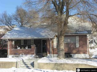
Located north of County Road 14 in the open high-desert country of Sweetwater County, this 640± acre deeded section sits on the west side of the Continental Divide within the upper Green River Basin — embodying the raw beauty and solitude of Wyoming's wide-open ranch country. The land features a blend of rolling benches, dry creek channels, and open ridges covered in native sagebrush and grass. With an elevation change of roughly 200 feet, the terrain offers both scenic vantage points and practical grazing ground. A permitted domestic and stock well (Permit #P111502.0W) provides a reliable water source producing approximately 9 gallons per minute, with two additional existing wells identified near the historic homestead area. The property includes remnants of early log homestead cabins, while later improvements such as welded-pipe corrals, loafing sheds, and gated fence corners reflect more recent agricultural use and livestock management. The section is fully perimeter fenced with a combination of woven and barbed wire in usable condition, providing solid boundary control for livestock operations. This property lies within the Rock Springs BLM Grazing Allotment (Allotment No. 13018). Surrounding public and private lands are grazed under the administration of the Rock Springs Grazing Association, which maintains leases that include holdings of Aggie Grazing LLC. The broader area reflects a long-established pattern of cooperative grazing use across both deeded and BLM lands. Native vegetation supports healthy rangeland and diverse wildlife habitat, with elk, mule deer, and pronghorn antelope frequently present. The property is situated within Elk Hunt Area 100 and Antelope Area 96, both known for strong game populations and consistent trophy quality. This region also carries a strong historical connection to Wyoming's early settlement era. The Green River–South Pass Stage Route, established in the late 1860s, passes near the property, and the original homestead patent dates back to 1937. These details, combined with the property's size, water availability, and wildlife presence, make this a unique parcel for buyers seeking authentic Western heritage and lasting land value. Additional well data, NRCS soil reports, and historical references are available upon request through the listing agent. Cody Renner. 307.438.1577
289 days
|
1,960
|
105
|
Zillow last checked:
Listing updated:
Listed by:
Cody Renner307-438-1577,
Timber Ridge Realty,
Lynn Ritter,
Timber Ridge Realty
Source: WYOMLS,MLS#: 20255472
Facts & features
Property
Features
Fencing: Barbed Wire,Sheep Wire,Full
Lot
Size: 640 Acres
Features: BLM, Private
Details
Additional structures: Corral(s), Loafing Sheds
Parcel number: 21053340001000
Zoning description: Agricultural
Utilities & green energy
Electric: None
Gas: None
Sewer: None
Water: Private, Well, Registered Well
Utilities for property: Phone Not Available, Electricity Not Available
All calculations are estimates and provided by Zillow, Inc. for informational purposes only. Actual amounts may vary.
HOA fees may include property taxes on listings classified as Co-Ops. Contact the listing agent and/or owner for fee details.
Mortgage interest rates are dependent on a number of factors, including credit score, down payment, and repayment length. Interest rate data provided by Zillow Group Marketplace, Inc. as of 1/1/1970 from various mortgage lenders with which we have lead or other similar arrangements; the Estimated Payment is an average of those rates.
See how much you could borrow to make a competitive offer.