This Townhouse style single family home offers 3 bedrooms and 1 bathroom with approximately 1280 square feet of living space on a 0.05 acre lot. There are no inspection or financing contingencies on this cash only purchase. The foreclosure deed has been recorded, allowing for shorter closing timelines. No Buyer Premium on this property. The buyer has the right to select their own title/closing company. The buyer is responsible for all closing costs in this transaction.
Auction

Est. $115,000
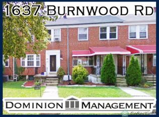
1641 Burnwood Rd, Baltimore, MD 21239
3beds
1,280sqft
Townhouse
Built in 1954
2,178 Square Feet Lot
$263,800 Zestimate®
$90/sqft
$-- HOA
Overview
- 66 days |
- 176 |
- 4 |
Zillow last checked:
Source: Xome
Facts & features
Interior
Bedrooms & bathrooms
- Bedrooms: 3
- Bathrooms: 1
- Full bathrooms: 1
Features
- Has basement: No
Interior area
- Total structure area: 1,280
- Total interior livable area: 1,280 sqft
Property
Features
- Stories: 2
Lot
- Size: 2,178 Square Feet
Details
- Parcel number: 27095267O580
- Special conditions: Auction
Construction
Type & style
- Home type: Townhouse
- Property subtype: Townhouse
Condition
- Year built: 1954
Community & HOA
Location
- Region: Baltimore
Financial & listing details
- Price per square foot: $90/sqft
- Tax assessed value: $200,933
- Date on market: 4/1/2026
- Lease term: Contact For Details
This listing is brought to you by Xome
View Auction DetailsEstimated market value
$263,800
$245,000 - $280,000
$2,038/mo
Public tax history
| Year | Property taxes | Tax assessment |
|---|---|---|
| 2025 | -- | $200,933 +8.2% |
| 2024 | $4,383 +8.4% | $185,700 +8.4% |
| 2023 | $4,042 +9.2% | $171,267 -7.8% |
| 2022 | $3,701 +10.1% | $185,700 +30.4% |
| 2021 | $3,361 +1.6% | $142,400 +1.6% |
| 2020 | $3,306 +1.7% | $140,100 -1.6% |
| 2019 | $3,252 +1.7% | $142,400 +5.1% |
| 2018 | $3,198 +0.8% | $135,500 +0.8% |
| 2017 | $3,172 +36.1% | $134,400 +0.8% |
| 2016 | $2,330 | $133,300 +0.8% |
| 2015 | $2,330 | $132,200 |
| 2014 | $2,330 | $132,200 |
| 2013 | -- | $132,200 -11.8% |
| 2012 | -- | $149,900 +1.5% |
| 2011 | -- | $147,630 +1.6% |
| 2010 | -- | $145,360 +1.6% |
| 2009 | -- | $143,090 +17.4% |
| 2008 | -- | $121,932 +21% |
| 2007 | -- | $100,776 +26.6% |
| 2006 | -- | $79,620 +2.1% |
| 2005 | -- | $77,970 +2.2% |
| 2004 | -- | $76,320 +2.2% |
| 2003 | -- | $74,670 +1.1% |
| 2002 | -- | $73,870 +1.1% |
| 2001 | -- | $73,070 |
Find assessor info on the county website
Climate risks
Neighborhood: Perring Loch
Nearby schools
GreatSchools rating
- 5/10Northwood Elementary SchoolGrades: PK-5Distance: 0.2 mi
- 5/10Stadium SchoolGrades: 6-8Distance: 2.4 mi
- 1/10Reginald F. Lewis High SchoolGrades: 9-12Distance: 1.2 mi
- Maryland
- Baltimore City
- Baltimore
- 21239
- Perring Loch
- 1641 Burnwood Rd
Nearby cities
Nearby neighborhoods
Nearby zip codes
Other Baltimore Topics
