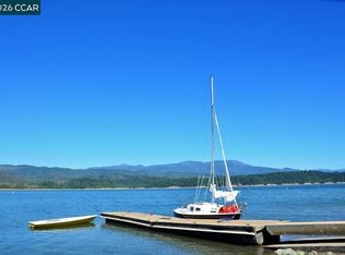
Water hook ups run to all the lots in the Pillsbury Ranch subdivision. Yearly water charge is $321 per year plus additional water charges upon completion of your new home.
Lot/land
$15,000
31253 High Point Rd, Potter Valley, CA 95469
--beds
--baths
1.49Acres
Unimproved Land
Built in ----
1.49 Acres Lot
$-- Zestimate®
$--/sqft
$65/mo HOA
What's special
- 15 days
- 59
- 8
Zillow last checked:
Listing updated:
Listed by:
William Polsley DRE #00442356 925-872-7498,
Buyer's Brokers Realty
Source: CCAR,MLS#: 41150955
Facts & features
Property
Lot
- Size: 1.49 Acres
- Features: None
Details
- Parcel number: 063331020000
- Zoning: SR
- Special conditions: Successor Trustee Sale
Utilities & green energy
- Sewer: None
- Water: Private
- Utilities for property: None
Community & HOA
Community
- Subdivision: Other
HOA
- Has HOA: Yes
- Amenities included: Pool, Gated
- Services included: Management Fee, Other
- HOA fee: $777 annually
- HOA name: LAKE PILLSBURY PROPERTY OWNERS ASSOCIATION
- HOA phone: 999-999-9999
Location
- Region: Potter Valley
Financial & listing details
- Tax assessed value: $9,802
- Date on market: 10/12/2026
Estimated market value
Not available
Estimated sales range
Not available
Not available
Price history
| Date | Event | Price |
|---|---|---|
| 10/12/2026 | Listed for sale | $15,000+37.6% |
Source:  CCAR #41150955 Report a problem | ||
| 4/17/2025 | Listing removed | $10,900 |
Source:  BAREIS #324083549 Report a problem | ||
| 2/20/2025 | Price change | $10,900-11.4% |
Source: BAREIS #324083549 Report a problem | ||
| 1/6/2025 | Price change | $12,300-10.9% |
Source: BAREIS #324083549 Report a problem | ||
| 10/18/2024 | Listed for sale | $13,800 |
Source: BAREIS #324083549 Report a problem | ||
Public tax history
| Year | Property taxes | Tax assessment |
|---|---|---|
| 2026 | -- | $9,802 +2% |
| 2025 | $123 -0.9% | $9,610 +2% |
| 2024 | $124 +3.6% | $9,422 +2% |
| 2023 | $120 -2.3% | $9,238 +2% |
| 2022 | $123 +2% | $9,057 +2% |
| 2021 | $121 +4.3% | $8,880 +1% |
| 2020 | $116 -1.1% | $8,789 +2% |
| 2019 | $117 +8.8% | $8,617 +2% |
| 2018 | $107 +2.1% | $8,449 +2% |
| 2017 | $105 | $8,284 +2% |
| 2016 | -- | $8,122 +8% |
| 2015 | -- | $7,517 +2% |
| 2014 | -- | $7,370 +0.4% |
| 2013 | $96 +0.7% | $7,337 +2% |
| 2012 | $95 +3.4% | $7,194 +2% |
| 2011 | $92 -0.6% | $7,053 +0.7% |
| 2010 | $93 +1.3% | $7,001 +1.8% |
| 2008 | $91 +2.7% | $6,880 +2% |
| 2007 | $89 +2.3% | $6,746 +2% |
| 2006 | $87 +0.3% | $6,614 +2% |
| 2005 | $87 +3% | $6,485 +2% |
| 2004 | $84 +0.1% | $6,358 +1.9% |
| 2003 | $84 +29.1% | $6,242 +2% |
| 2002 | $65 +1% | $6,120 +2% |
| 2001 | $65 -49.9% | $6,000 -51.9% |
| 2000 | $129 | $12,466 |
Find assessor info on the county website
Monthly payment
Climate risks
Neighborhood: 95469

Local buyer's agents are ready to help
