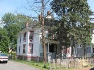
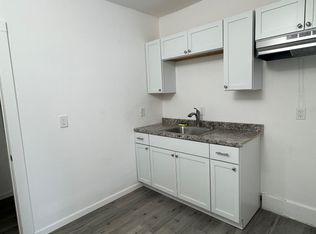
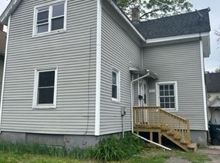
This 3062 square foot single family home has 7 bedrooms and 3.0 bathrooms. This home is located at 69 Sherman St, Springfield, MA 01109.
Auction

Est. $358,700
69 Sherman St, Springfield, MA 01109
7beds
3baths
3,062sqft
Other
Built in 1911
6,098 Square Feet Lot
$358,700 Zestimate®
$--/sqft
$-- HOA
Overview
- 6 days
- 40
- 4
Zillow last checked:
Listed by:
Customer Service,
ServiceLink Auction
Source: ServiceLink Auction
Facts & features
Interior
Bedrooms & bathrooms
- Bedrooms: 7
- Bathrooms: 3
Interior area
- Total structure area: 3,062
- Total interior livable area: 3,062 sqft
Property
Lot
- Size: 6,098 Square Feet
Details
- Parcel number: SPRIS10805P0052
- Special conditions: Auction
Construction
Type & style
- Home type: SingleFamily
- Property subtype: Other
Condition
- Year built: 1911
Community & HOA
Location
- Region: Springfield
Financial & listing details
- Tax assessed value: $302,500
- Annual tax amount: $4,743
- Date on market: 10/31/2026
- Lease term: Contact For Details

Estimated market value
$358,700
$334,000 - $384,000
$2,143/mo
Public tax history
| Year | Property taxes | Tax assessment |
|---|---|---|
| 2025 | $4,743 +3.9% | $302,500 +6.5% |
| 2024 | $4,563 +10.3% | $284,100 +17.1% |
| 2023 | $4,136 -5.9% | $242,600 +3.9% |
| 2022 | $4,393 +30.3% | $233,400 +30.8% |
| 2021 | $3,372 -0.6% | $178,400 +41.1% |
| 2020 | $3,394 +42.1% | $126,400 +4.1% |
| 2019 | $2,389 +3.9% | $121,400 +3.9% |
| 2018 | $2,299 +0.1% | $116,800 |
| 2017 | $2,296 +22.2% | $116,800 +22.2% |
| 2016 | $1,879 +6.4% | $95,600 +6.5% |
| 2015 | $1,766 +1.6% | $89,800 +1.8% |
| 2014 | $1,738 -0.2% | $88,200 -0.2% |
| 2013 | $1,742 -11.3% | $88,400 -10.7% |
| 2012 | $1,963 -8.1% | $99,000 -9.7% |
| 2011 | $2,136 -0.1% | $109,600 -0.1% |
| 2010 | $2,139 -2.3% | $109,700 -10.4% |
| 2009 | $2,190 +3.6% | $122,400 -7.2% |
| 2008 | $2,114 -4.4% | $131,900 -4.4% |
| 2007 | $2,212 +21.5% | $137,900 +28.8% |
| 2006 | $1,821 +10.2% | $107,100 +13.5% |
| 2005 | $1,653 +0.9% | $94,400 +9.4% |
| 2004 | $1,639 +3.1% | $86,300 +5.4% |
| 2003 | $1,590 +6.2% | $81,900 +8.8% |
| 2002 | $1,497 | $75,300 |
Find assessor info on the county website