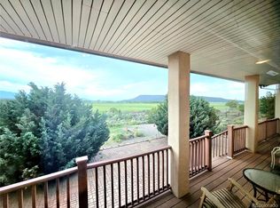
6958 TRINCHERA RANCH ROAD. The address and name says it all. A 5-acre homesite on one of the most desirable lots Block 316 Unit H-3 one of three lots on a slightly lifted elevation and directly across from the Trinchera Ranch Resort. This location has stunning 360-degree views of Trinchera Peak, Gato Peak, and primary views of the Sangre de Cristo range, the winter feeding grass meadows of the Ranch as well as a full view of Mt. Home Reservoir. To the rear is the top view of Blanca Peak. To the distant front of the property-there is a 22-mile view all the way to Amalia Peak NM at Vermijo Park.
This homesite requires both well and septic permits -depending on the size of your build. It also boasts a Highway grade gravel driveway (primed for paving), leading to the top platform building site equipped with high end RV electric panel 50/30/110 amp and septic tank for hook up. One of very few lots on the paved Trinchera Ranch Road leading to Highway 160. Immediate proximity to all recreational sports activities at the State managed Mt. Home Reservoir. (See pics of satellite imagery for Stevenson driveway survey of 2012).
This location provides front row seats to the winter and year-round grazing to one of the largest Elk herds in North America, the second largest elk population is in northern NM an southern CO - between the Sangre de Cristo’s and the San Juan Mountain range to the west. This location becomes the center of the universe under a Full Moon, when it illuminates the peaks, the river below, and the reservoir. It is the thrill of a lifetime to see the Elk herd swimming and frolicking in the river under a Full Moon,, This area may well be the location of the historic military encampment called ‘Camp Corkscrew’ which predates Fort Garland. The original cartographer survey map from New Mexico territory depicted the peaks in their current location as well as the creek and noted the 20-mile distance to Amalia peak NM to the south.
Sold for $52,000
$52,000
6958 Trinchera Ranch Rd, Fort Garland, CO 81133
--beds
--baths
5.45Acres
Unimproved Land
Built in ----
5.45 Acres Lot
$-- Zestimate®
$--/sqft
$-- Estimated rent
Home value
Not available
Estimated sales range
Not available
Not available
Zestimate® history
Loading...
Owner options
List your home for rent
Find your next renter with Zillow Rental Manager. Plus, with online applications, you can quickly screen prospective tenants – for free.
Learn moreRefinance and save
$233/mo
Est. payment
Refinancing to a lower rate could help reduce your monthly payments and save thousands over the life of the loan.
See today's rates$233/mo
Est. payment
Explore your selling options
Work with a Zillow partner agent
Leverage their expertise and Zillow's premium Showcase listings to get your home seen by more buyers.
Get startedList with your own agent
Get your home in front of millions of buyers by listing it on Zillow.
Learn how to do itSell it yourself
Take full control of how buyers see your home on Zillow by listing For Sale by Owner (FSBO).
List your homeWhat's special
Zillow last checked: 7 hours ago
Listing updated: November 01, 2024 at 12:13pm
Listed by:
Maggie Duarte 719-588-4861 duarte2009@gmail.com,
Colorado Realty & Land Co.
Bought with:
Maggie Duarte, 121731
Colorado Realty & Land Co.
Source: REcolorado as distributed by MLS GRID,MLS#: 2351861
Facts & features
Property
Lot
- Size: 5.45 Acres
- Features: Many Trees
- Residential vegetation: Wooded
Details
- Parcel number: 70231240
- Zoning: Rural
- Special conditions: Standard
Utilities & green energy
- Electric: 110V
Community & neighborhood
Location
- Region: Fort Garland
- Subdivision: Sangre De Cristo Ranches
Other
Other facts
- Listing terms: Cash,Conventional
- Ownership: Individual
- Road surface type: Paved
Price history
| Date | Event | Price |
|---|---|---|
| 11/1/2024 | Sold | $52,000 |
Source: | ||
| 10/1/2024 | Listed for sale | $52,000 |
Source: | ||
| 9/30/2024 | Pending sale | $52,000 |
Source: | ||
| 7/23/2024 | Listed for sale | $52,000 |
Source: | ||
| 7/10/2024 | Pending sale | $52,000 |
Source: | ||
Public tax history
Tax history is unavailable.
Neighborhood: 81133

Nearby schools
GreatSchools rating
- 4/10Sierra Grande SchoolGrades: PK-12Distance: 5.6 mi
Schools provided by the listing agent
- District: Sierra Grande R-30
Source: REcolorado as distributed by MLS GRID. This data may not be complete. We recommend contacting the local school district to confirm school assignments for this home.
- Colorado
- Costilla County
- Fort Garland
- 81133
- 6958 Trinchera Ranch Rd