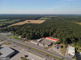
The Cropper Tract is 495+/- deeded acres of timber east of Snow Hill. The property is conserved under a Maryland Department of Natural Resources Easement. Tax map boundaries are incorrect. There is a acreage discrepancy between the deed and tax records. Boundary in photo may not accurately represent the true boundaries of the property. Do not enter the property without permission of The Land Group. Timber Resource Disclosure The timber resource information contained in this marketing package, including but not limited to stand maps, timber type classifications, acreage, age classes, and volume estimates, is based upon information provided by the property owner's resource manager and other available sources. Such information is presented for general informational purposes only and may not reflect current field conditions. The Land Group has not independently verified this information and makes no representation or warranty as to its accuracy or completeness. Purchasers should conduct their own due diligence and rely upon their own inspections and the advice of qualified forestry professionals. No warranty or guarantee is made by The Land Group or the property owner regarding timber volumes, acreage, age classes, species composition, or any other timber resource data.
Lot/land
$980,496
Basket Switch Rd, Newark, MD 21841
--beds
--baths
495.2Acres
Unimproved Land
Built in ----
495.2 Acres Lot
$-- Zestimate®
$--/sqft
$-- HOA
What's special
- 117 days
- 282
- 11
Zillow last checked:
Listing updated:
Listed by:
Benjamin Alder 443-865-1344,
The Land Group (410) 934-3478
Source: Bright MLS,MLS#: MDWO2039496
Facts & features
Property
Lot
- Size: 495.2 Acres
Details
- Parcel number: 04003896
- Zoning: AR
- Special conditions: Standard
Utilities & green energy
- Sewer: No Septic System
- Water: None
Community & HOA
HOA
- Has HOA: No
Location
- Region: Newark
Financial & listing details
- Tax assessed value: $38,700
- Annual tax amount: $487
- Date on market: 7/1/2026
- Listing agreement: Exclusive Right To Sell
- Ownership: Fee Simple
Estimated market value
Not available
Estimated sales range
Not available
$2,100/mo
Price history
| Date | Event | Price |
|---|---|---|
| 10/2/2026 | Listed for sale | $980,496-6.3% |
Source:  Bright MLS #MDWO2039496 Report a problem | ||
| 2/14/2023 | Listing removed | $1,046,500 |
Source: Bright MLS #MDWO2006834 Report a problem | ||
| 3/31/2022 | Listed for sale | $1,046,500 |
Source: Bright MLS #MDWO2006834 Report a problem | ||
Public tax history
| Year | Property taxes | Tax assessment |
|---|---|---|
| 2026 | $489 | $38,700 |
| 2025 | $489 +32% | $38,700 |
| 2024 | $370 | $38,700 |
| 2023 | $370 | $38,700 |
| 2022 | $370 | $38,700 |
| 2021 | $370 | $38,700 |
| 2020 | $370 | $38,700 |
| 2019 | $370 +1.1% | $38,700 |
| 2018 | $366 | $38,700 |
| 2017 | $366 -5.9% | $38,700 |
| 2016 | $390 | $38,700 |
| 2015 | $390 | $38,700 |
| 2007 | -- | $38,700 |
| 2006 | -- | $38,700 |
| 2005 | -- | $38,700 |
| 2004 | -- | $38,700 |
| 2003 | -- | $38,700 |
Find assessor info on the county website
Monthly payment
Climate risks
Neighborhood: 21841
Nearby schools
Schools provided by the listing agent
- District: Worcester County Public Schools
Source: Bright MLS. This data may not be complete. We recommend contacting the local school district to confirm school assignments for this home.
Similar homes
- $751,740402 acres0 Flower Hill Church Rd, Eden, MD 21822Lot/Land

 MLS ID #MDSO2007208, Benjamin Alder, The Land Group. Bright MLS
- $697,790373.15 acres0 Johnson Rd, Pocomoke City, MD 21851Lot/Land
 MLS ID #MDWO2039494, Benjamin Alder, The Land Group. Bright MLS
- $975,00014.87 acresLOT 4A 4b Stephen Decatur Hwy, Berlin, MD 21811Lot/Land
 MLS ID #MDWO2037068, homecoin.com Minerick, Homecoin.com. Bright MLS
- $850,00081.6 acresOld Virginia Rd, Pocomoke City, MD 21851Lot/Land
 MLS ID #MDWO2041674, Craig Glovier, Long & Foster Real Estate, Inc.. Bright MLS
- $599,00011.93 acresN Main St, Berlin, MD 21811Lot/LandMLS ID #MDWO2041676, Michael Maykrantz, Seaside Resort Group, LLC. Bright MLS
- $699,00068.1 acres0 Richardson Rd, Willards, MD 21874Lot/LandMLS ID #MDWC2020380, Rusty Molnar, Keller Williams Realty Delmarva. Bright MLS
- $1,300,0005.43 acres15 Newport Dr, Berlin, MD 21811Lot/LandMLS ID #MDWO2040546, David Dypsky, Newport Bay Realty. Bright MLS
- $550,00044.58 acresCasher Wells Rd, Pittsville, MD 21850Lot/LandMLS ID #MDWC2023422, Kelly Jeter, SVN |Miller Commercial Real Estate. Bright MLS
- $500,0009.81 acresPolly Branch Rd, Selbyville, DE 19975Lot/LandMLS ID #DESU2121678, Danny TAGLIENTI, Keller Williams Realty. Bright MLS
- $529,0003.69 acresLOT 23 Hampton Rd, Berlin, MD 21811Lot/LandMLS ID #MDWO2037670, David Dypsky, Newport Bay Realty. Bright MLS
- $500,00015.45 acres0 Blue Marlin Dr, Ocean City, MD 21842Lot/LandMLS ID #MDWO2038668, Dan O'Hare, Coldwell Banker Realty. Bright MLS
- $895,00017.77 acres0 Ocean Hwy, Pocomoke, MD 21851Lot/LandMLS ID #MDSO2007960, Ryan Finnegan, SVN |Miller Commercial Real Estate. Bright MLS
- $599,0008.49 acres6794 Bent Pine Rd, Willards, MD 21874Lot/LandMLS ID #MDWC2015822, Roger Sansom, ERA Martin Associates. Bright MLS
- $579,00020.06 acres0 Old Eden Rd, Eden, MD 21822Lot/LandMLS ID #MDWC2016504, David Kaufmann, Eastern Shore Real Estate, LLC. Bright MLS
- $750,0007.47 acres37214 Hudson Rd, Selbyville, DE 19975Lot/LandMLS ID #DESU2060144, Gary Brittingham, JACK LINGO MILLSBORO. Bright MLS
- $799,0002.31 acres10301 Kennebunk Ct, Ocean City, MD 21842Lot/LandMLS ID #MDWO2039032, Mr. Tom S Hennerty, NetRealtyNow.com, LLC. Bright MLS
- $639,0003.72 acresLOT 3B E Naylor Mill Rd, Salisbury, MD 21804Lot/LandMLS ID #MDWC2024904, Pam Price, Berkshire Hathaway HomeServices PenFed Realty. Bright MLS
- $1,195,0004.78 acres225 Moonglow Rd, Fruitland, MD 21826Lot/LandMLS ID #MDWC2011366, William Rinnier, Rinnier Development Co. Bright MLS
