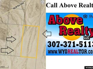
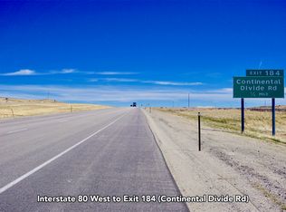
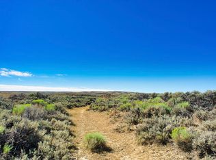
You are buying land for $400 per acre, which is some of the lowest priced rural acreage to be found anywhere in the United States. The land is raw, unimproved, without power, water, or maintained roads, but there are roads running very close to the property. I have been to the property and was able to drive the maintained roads with a Prius, but I recommend a truck or 4WD vehicle, especially if you want to get on the exact land. Ideal acreage for camping, hiking, outdoor enjoyment or simply as an inheritance for children/grandchildren, then this property might be ideal for you. With the price of real estate, this is a great investment for the future. Access to this property is per long standing Bureau of Land Management (BLM) policies, meaning private owners can cross BLM land to get to private property but the public can't cross private lands to get to BLM property. This checkerboard region (alternate sections of private and public ownership) means that private property owners can enjoy hundreds of thousands of acres that the general public can’t legally access! As in most oil producing states the mineral rights have been owned by exploration companies for many years but the landowner would receive some form of compensation if a well is ever drilled. This property was once surveyed by the federal government, but this specific 40-acre tract has never been surveyed. Taxes are about $50 per year. The property is currently zoned for what would be considered "agricultural" purposes and if additional uses are anticipated a potential buyer should contact the Sweetwater County Planning and Zoning Department. Directions: From Rawlins, proceed west on I-80 approximately 18 miles to Riner Road (Exit 196), then north on Riner Road approximately 12 miles to the parcel. Legal information: NE1/4SW1/4, Section 33, T22N, R91W of the 6th PM Sweetwater County, Wyoming (BT 40) PIDN: 2291-33-3-00-042-00 Property Taxes: Treasurer R126812 Legal Description: T22N R91W SEC 33 NE4SW4 Parcel: 2291-28-1-00-001-00 Tax Classification: Exempt Tax Roll Acreage: 640 Levy District: 0100, SD 1 OUT Geo Code: 04-2291-33-3-00-042.00 Deed Book: 1163, Page: 0555 Last Date of Purchase: 04/13/2010 Property address: 0 LARSON KNOLL, OUT OF COUNTRY 100 WY LO100 Legal: T22N R91W SEC 33 NE4SW4 Approximate coordinates: +41° 50' 2.45", -107° 41' 30.66" or (41.833, -107.691)
This property is off market, which means it's not currently listed for sale or rent on Zillow. This may be different from what's available on other websites or public sources.