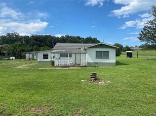
Looking for an acre of land in the Brandon/Valrico Area? Here it is Clean 1 Acre parcel off of Guiles Road. Build your Dream Home! Close to Great Schools (public and private), Libraries, Restaurants, Hospital, Medical Centers/Offices with a variety of Specialties, Shopping, Fitness Centers and more... Close to Brandon Mall, Selmon Expressway and I-75. NO HOA, NO CDDs.
Sold for $180,000
$180,000
Guiles Rd, Brandon, FL 33511
--beds
0baths
1Acres
VacantLand
Built in ----
1 Acres Lot
$-- Zestimate®
$--/sqft
$2,017 Estimated rent
Home value
Not available
Estimated sales range
Not available
$2,017/mo
Zestimate® history
Loading...
Owner options
List your home for rent
$2,017/mo
Rent Zestimate®
Find your next renter with Zillow Rental Manager. Plus, with online applications, you can quickly screen prospective tenants – for free.
Learn more$2,017/mo
Rent Zestimate®
Refinance and save
$1,190/mo
Est. payment
Refinancing to a lower rate could help reduce your monthly payments and save thousands over the life of the loan.
See today's rates$1,190/mo
Est. payment
Explore your selling options
Work with a Zillow partner agent
Leverage their expertise and Zillow's premium Showcase listings to get your home seen by more buyers.
Get startedList with your own agent
Get your home in front of millions of buyers by listing it on Zillow.
Learn how to do itSell it yourself
Take full control of how buyers see your home on Zillow by listing For Sale by Owner (FSBO).
List your homeWhat's special
Originating MLS: Tampa
Facts & features
Interior
Bedrooms & bathrooms
- Bathrooms: 0
Property
Lot
- Size: 1 Acres
- Dimensions: 208.71x208.71
Details
- Parcel number: 203001ZZZ000002752701U
- Zoning: ASC-1
Utilities & green energy
- Sewer: Public Sewer
- Utilities for property: Public
Community & neighborhood
Location
- Region: Brandon
- Subdivision: UNPLATTED
Other
Other facts
- Additional Parcels YN: 0
- Country: US
- For Lease YN: 0
- Listing Service: Full Service
- Ownership: Fee Simple
- Property Type: Land
- Syndicate To: Homes.com, HomeSnap, Realtor.com, International MLS
- Water Access YN: 0
- Water Extras YN: 0
- Waterfront YN: 0
- Water View YN: 0
- Major Change Type: Pending
- Mls Status: Pending
- Previous Status: Active
- Utilities: Public
- Waterfront Feet Total: 0
- Flood Zone Code: X
- Sewer: Public Sewer
- Flood Zone Date: 2008-08-28
- Public Survey Section: 01
- County Or Parish: Hillsborough
- List Agent AOR: Tampa
- List AOR: Tampa
- Public Survey Range: 20
- MLS Area Major: 33511 - Brandon
- Subdivision Name: UNPLATTED
- Zoning: ASC-1
- Current Use: Residential
- Flood Zone Panel: 12057C0394H
- Front Footage: 208
- Tax Annual Amount: 1049.00
- Tax Year: 2020
- Total Acreage: 1 to less than 2
- Lot Size Dimensions: 208.71x208.71
- Ownership: Fee Simple
Price history
| Date | Event | Price |
|---|---|---|
| 2/29/2024 | Sold | $180,000-2.7% |
Source: Public Record Report a problem | ||
| 10/3/2022 | Sold | $185,000-2.6% |
Source: Public Record Report a problem | ||
| 9/2/2022 | Pending sale | $189,900 |
Source: | ||
| 8/28/2022 | Price change | $189,900-15.6% |
Source: | ||
| 6/13/2022 | Listed for sale | $225,000+43.4% |
Source: Owner Report a problem | ||
Public tax history
| Year | Property taxes | Tax assessment |
|---|---|---|
| 2024 | $1,699 +8.6% | $98,000 +8.9% |
| 2023 | $1,565 +19.2% | $90,000 +20% |
| 2022 | $1,313 +18.3% | $75,000 +21% |
Find assessor info on the county website
Neighborhood: 33511
Nearby schools
GreatSchools rating
- 7/10Brooker Elementary SchoolGrades: PK-5Distance: 1.2 mi
- 5/10Burns Middle SchoolGrades: 6-8Distance: 0.6 mi
- 8/10Bloomingdale High SchoolGrades: 9-12Distance: 0.9 mi