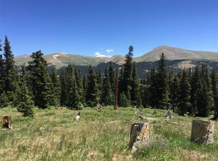
Experience a very rare opportunity to own 20.66 acres of outstanding views of Park and Summit Counties from 12,500 Feet on a famous Colorado 14'er next to a stream. This is above tree line with amazing views and 30ft from a year-round stream (Dolly Varden). The stream is under the snow in the picture. During late April to June, a couple small seasonal streams run through the the property. Fall in love with this 14'er for its rich mining history as this is the "gateway" to the summit of Mt. Bross. Below the property is the famous Windy Ridge Bristle-cone Pine area that reaches the edge of the property along the Dolly Varden Stream and has some Bristle-cone Pines on the property. The property has direct road access when the snow has melted (Open from late May to late October). Property can be accessed from below residential area for winter hiking/snow shoes (November to April). ***This property is above tree line and you cannot build a house*** You can build a mining shed or other structures, but no residential housing. No building permit is required for a 12' x 10' mining shed, but anything larger requires a building permit. You can bring a micro-house (on wheels) or trailer camper to camp on the property for as long as you like. Property is zoned as Industrial, not Residential. The opportunities are endless that range from potential Wireless Communications Site, Silver Prospecting, Camping, Private Ski Area, Shooting Range, Extreme Biking, Hand Gliding/Parasailing, Nature Reserve, Recreational Site, etc. In addition, a very long year-round ski run exists next to property that is also a water source (Dolly Varden Stream). You will find some remains of an old power line that fed the famous Dolly Varden gold mine located approximately ¾ mile up Mt. Bross. The property has lots of wild flowers, Bristle-cone Pines, Shrubs, and two seasonal streams from snow run-off. A dirt road goes through the property for seasonal access. The property is very strategic as it controls the access to the top of Mt. Bross and is considered a "gateway" property. The land does contain lode claim posts were Silver was found. The property has all 6 survey markers easily visible with rocks that have the engraved MS# 12474 on each corner. Each property is the shape of a rectangle side-by-side. The coordinates for the property are 39.326364, -106.0882222. The land was surveyed on February 25, 1898 and was designated at Highland Chief Extension and Sparkhill Lodes. A USGS marker is on the property. Property comes with land and mineral rights. Taxes for the property are less than $50 a year for 2016. To access the property from Alma, take County Road 8; which starts as Buckskin Street in the town of Alma. This moderate dirt road takes you to Kite Lake. On the way to Kite Lake there is a trail going north, and a sign marking how far it is to Kite Lake. Bear right at fork in road towards Windy Ridge Bristle-cone area. Road not suitable for a sedan vehicle and requires 4 x 4. Road opens late May after snow-melt. Schedule Numbers 91170, 91169. Property in Section 27 on map. Look for highlighted section. Rectangle shaped. Please no agents, brokers, or third parties. Selling land, no leases. Price firm, Cash Only. Serious offers only. Mount Bross, Mt Bross, Alma, Colorado, Vacant Land, Fairplay, Four Fourteeners, 14'er, Montgomery Reservoir, Mt Lincoln, Kite Lake, Alpine, Bross, 14ers, extreme sports, recreational land, camping.
This property is not currently displayed as for sale or rent on Zillow. This may be different from what's on other websites or public sources.